
Research
Understanding our ocean before we try to change it. Long-term monitoring across the GITA NADA Marine Protected Area, in southwest Lombok.
Marine research
Effective conservation starts with understanding
SORCE sits inside the GITA NADA Marine Protected Area, where coral reefs, seagrass meadows, mangrove forests and coastal communities form one connected marine landscape.
Since our field site was established in 2019 we have been building an increasingly detailed picture of what lives here, how habitats differ across the marine protected area (MPA), how communities change through time, what pressures they face, and how those changes can best be detected.
This is not research for its own sake. What we collect identifies conservation priorities, shapes and tests our own projects, contributes to scientific knowledge, and gives evidence to the Indonesian authorities and organisations responsible for managing this environment.
Because our monitoring is repeated year after year, every survey adds to something increasingly valuable: a long-term ecological record of our corner of Indonesia’s marine environment.
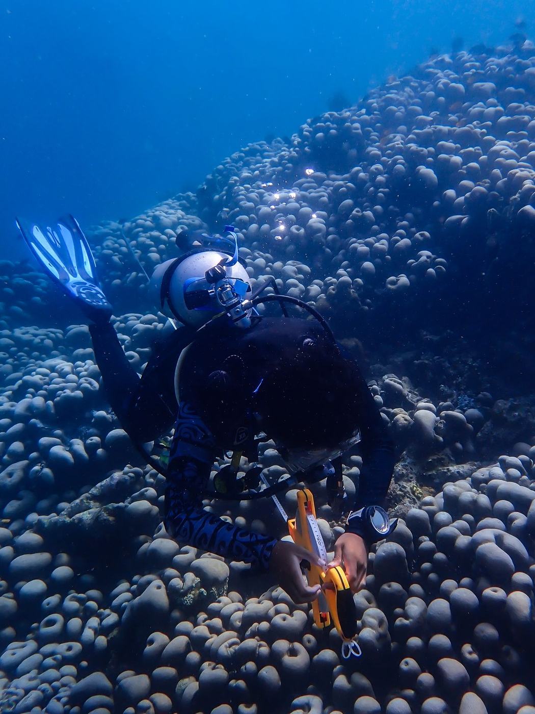
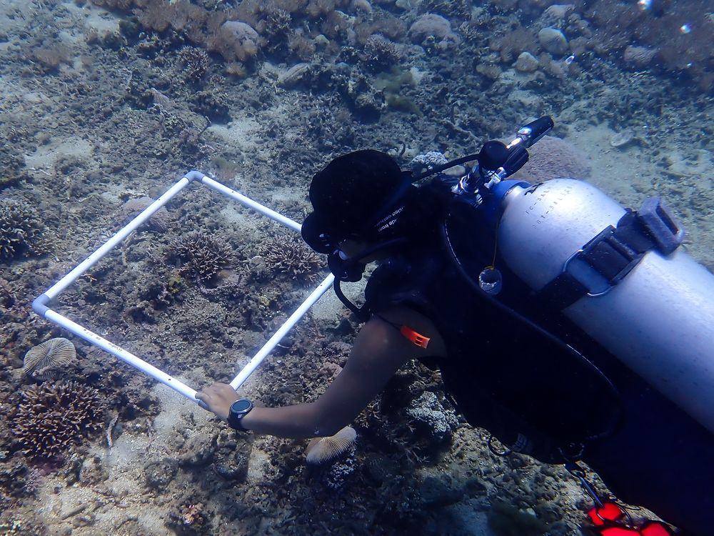
GITA NADA Marine Protected Area
By the numbers
A long-term record in figures
Coral cover at deeper monitoring sites averages 17.5%, which is why we treat the MPA as a set of different reefs rather than one uniform ecosystem.
- 46
- MPA monitoring stations
- 244
- BRUV deployments, 2023 to 2025
- 328
- Hours of underwater footage
- 32.6%
- Mean live coral cover, shallow sites
What we monitor
Six programmes, one connected picture
Rather than measuring coral alone, our monitoring looks at the whole reef community, and at the habitats either side of it.
 01 · Long-term monitoring
The marine protected area
46 Monitoring stations
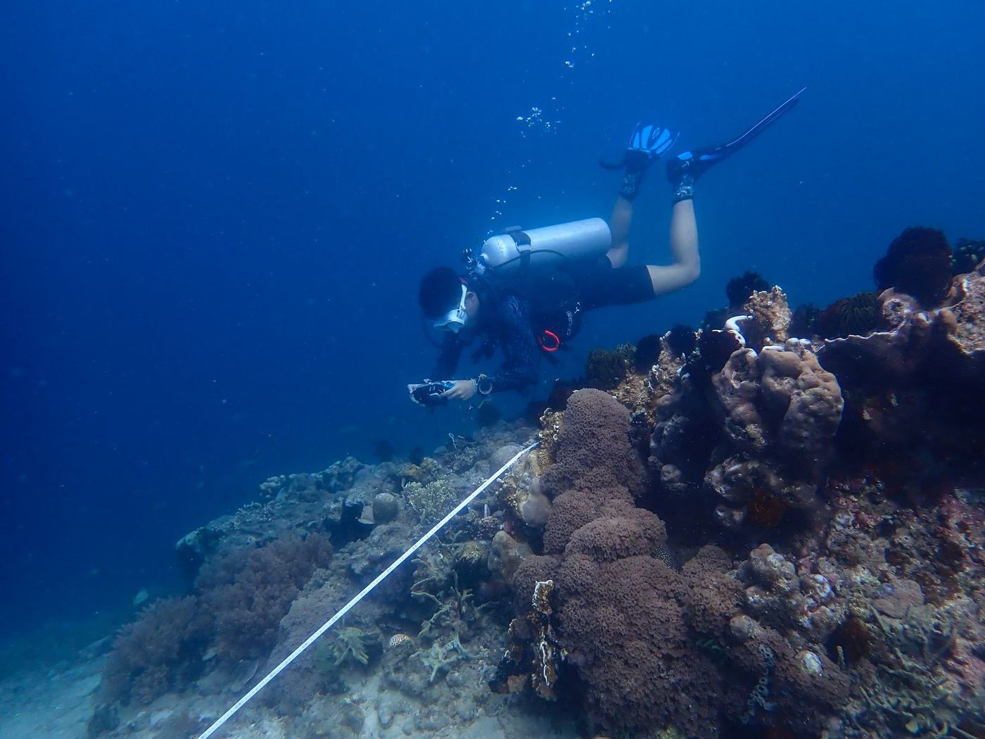
One of the foundations of our research is the long-term monitoring of GITA NADA. Our team surveys a core set of sites regularly, and plans a full survey of all 46 monitoring stations every five years; the first of these gave us our baseline dataset. Together they let habitats, depths, locations and conditions be compared, and ecological change be tracked through time.
What each survey records
- Coral and benthic cover
- Reef substrate and habitat condition
- Reef fish abundance and community composition
- Herbivorous and ecologically important fish groups
- Invertebrates
- Turtles, rays, sharks and other priority species
- Reef impacts and anthropogenic pressures
- Condition across different depths and locations
-
 46
Monitoring stations
-
 1,240
Surveys completed to date
-
 2019
Field site established
 02 · Coral reefs
Measuring the foundation of the reef
32.6% Live coral cover, shallow sites
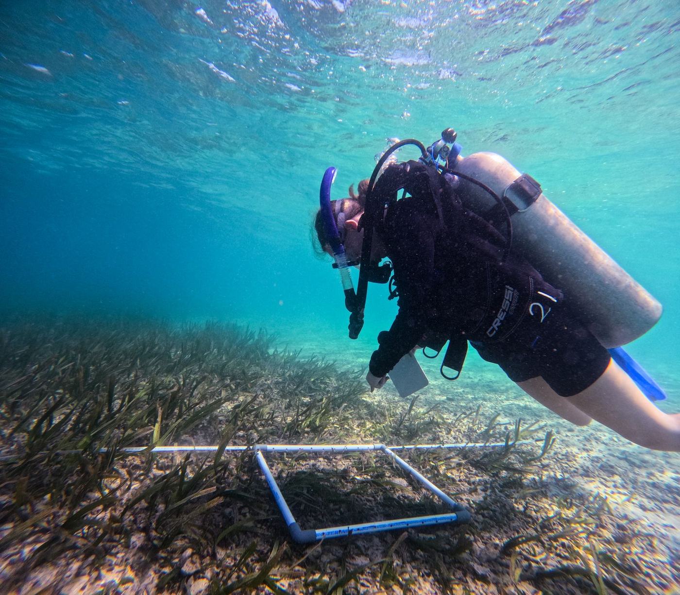
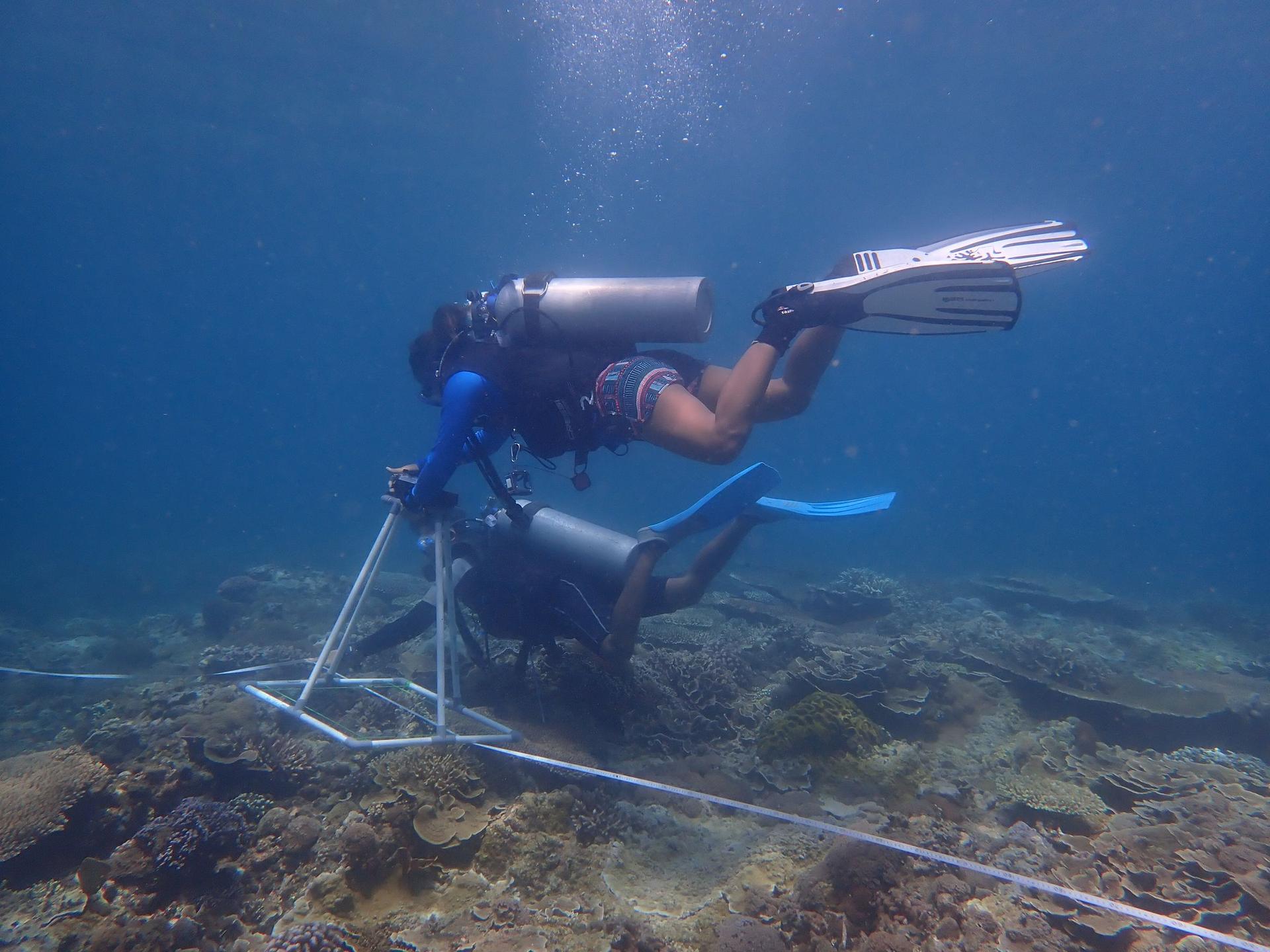
Understanding what covers the seabed is fundamental to understanding a reef. We run repeated benthic assessments using underwater photo transects and other standardised methods.
Photographs make permanent records: our scientists analyse composition in detail back at the field centre, and the same images can be revisited years later as analytical methods improve.
Recent analysis found mean live coral cover of about 32.6% at shallow sites and 17.5% at deeper ones, a reminder that spatial variation matters.
What we examine
- Live hard coral cover
- Coral community composition
- Algae
- Substrate
- Rubble and sand
- Other benthic organisms
- Coral damage and reef impacts
- Change through time
-
32.6%
Live coral cover, shallow sites
-
 17.5%
Live coral cover, deeper sites
-
 860
Photo transects analysed
 03 · Reef fish
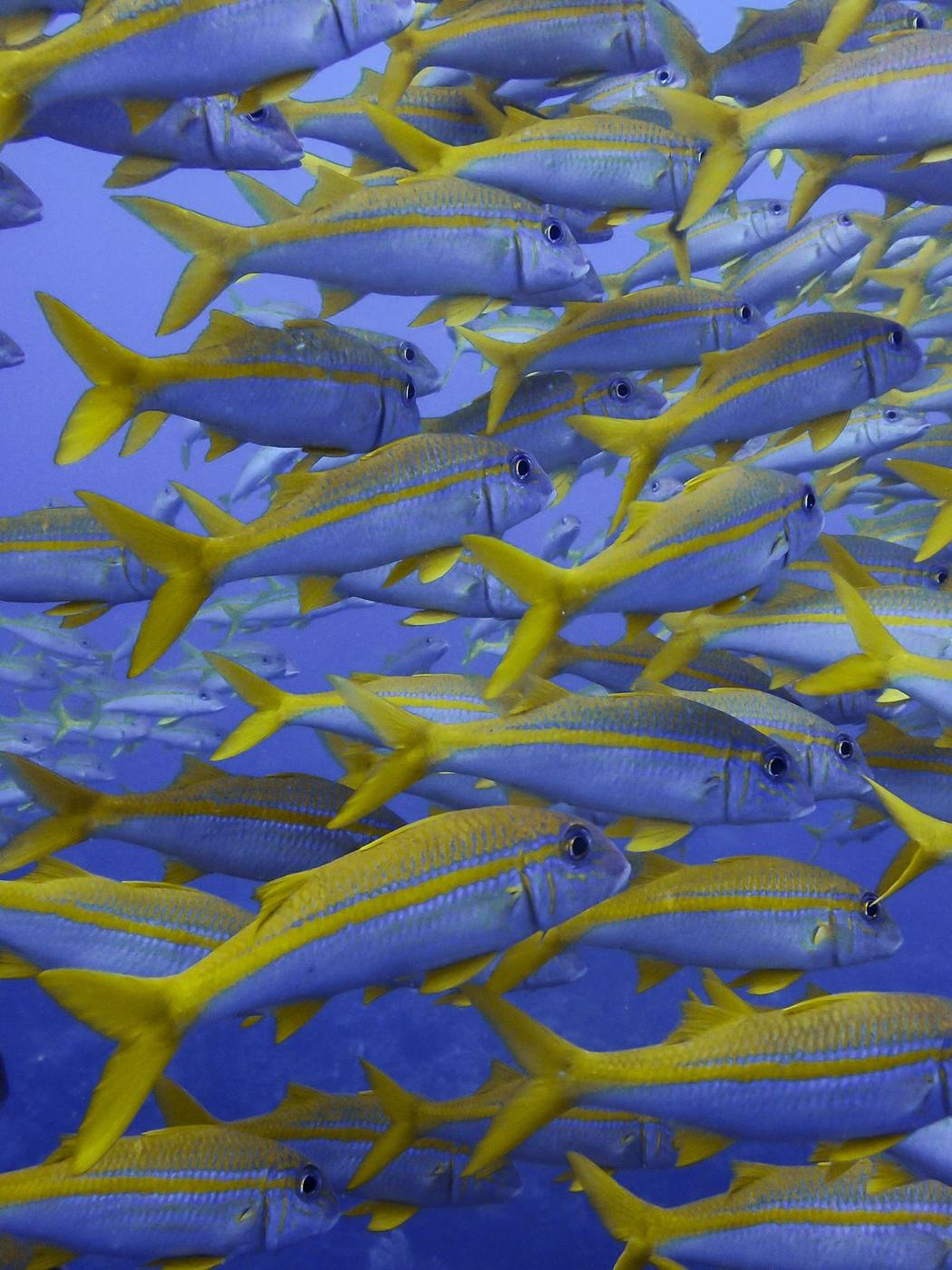
Reefs are communities, not collections of corals
62 Fish families recorded
We monitor the fish communities that depend on these habitats, looking at abundance, diversity and community structure across the marine protected area.
That lets us ask ecological questions while tracking groups that reveal something wider: reef condition, fishing pressure, ecosystem function.
The work involves extensive identification training, so our scientific team and suitably trained participants can tell apart the Indo-Pacific groups they meet on a survey. Long-term datasets then open up questions of seasonality, habitat association and depth.
-
 62
Fish families recorded
-
 410
Species on our ID list
-
380
Fish surveys completed
 04 · BRUV monitoring
Watching the reef without divers
244 BRUV deployments, 2023 to 2025
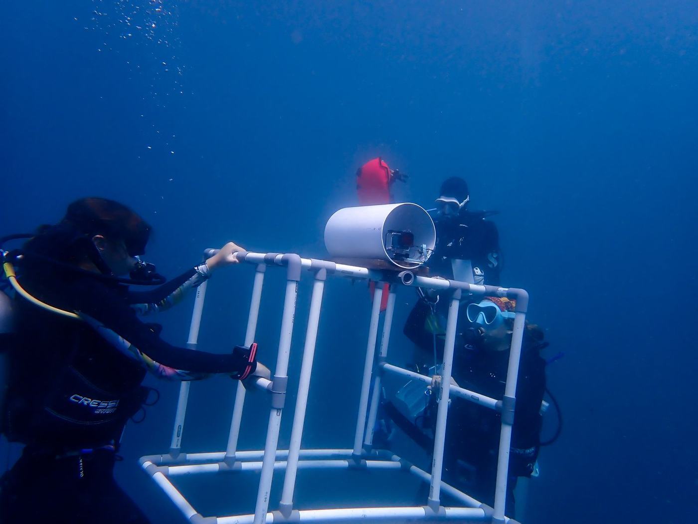
Not every animal behaves naturally with a diver present. Baited remote underwater video (BRUV) systems let us place a camera on the seabed and record what arrives, largely undisturbed.
Between January 2023 and December 2025 alone, the programme produced 244 deployments and roughly 328 hours of footage. That dataset has already supported peer-reviewed research into deep learning and automated video analysis for detecting ecologically important animals.
What the footage lets us investigate
- Fish assemblages and predators
- Sharks and rays
- Turtles
- Large reef fishes and other priority species
- Habitat associations
- Spatial and temporal patterns
- Automated ecological monitoring
-
 244
BRUV deployments, 2023 to 2025
-
 328
Hours of footage recorded
-
 1
Peer-reviewed paper supported
 05 · Priority species
Every encounter can also be data
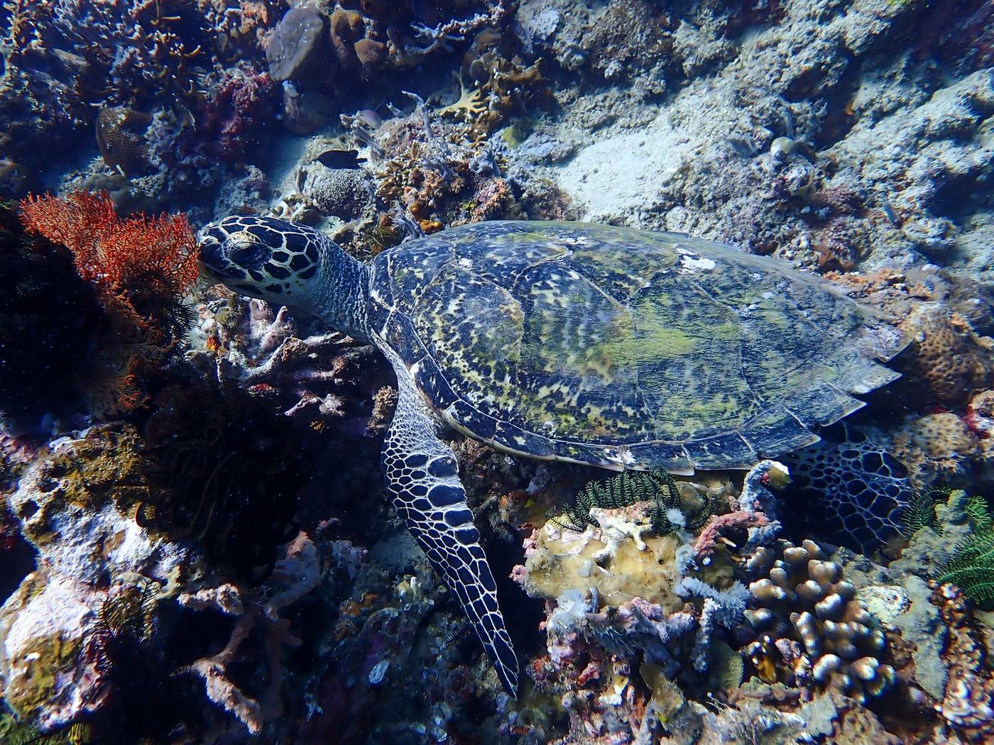
128 Turtles individually identified
Few things underwater are as memorable as a turtle, a shark or a ray. For our research team, each sighting is also a record.
We log every priority species encounter and for some can use photographs to identify individuals. Turtles are identified with Internet of Turtles, a global database, so each photograph adds to an individual’s record and longer-term population information.
BRUV footage, survey observations and chance encounters complement one another, building a fuller picture of the larger animals using the MPA.
-
 128
Turtles individually identified
-
 44
Manta records held
-
 12
Shark and ray species recorded
 06 · Mangroves and seagrass
The habitats either side of the reef
30,000 Mangrove nursery capacity
Mangrove forests are essential to this coast: habitat, shoreline protection, carbon storage, and the connection between land and sea. Research underpins our restoration work: we assess habitat, map degradation, monitor restoration sites and judge where planting is appropriate and whether it is establishing. That includes the nursery at Siung, the small village beside our field centre in Sekotong, with capacity for around 30,000 propagules.
Seagrass meadows are among the most productive coastal ecosystems and among the most overlooked. We monitor their distribution and condition, and how they interact with the mangroves and reefs beside them.
We are not currently restoring seagrass. The focus is on understanding it, so that conservation decisions stay evidence-led and appropriate to local conditions.
-
 30,000
Mangrove nursery capacity
-
8
Mangrove sites monitored
-
 14
Seagrass survey sites
Technology in the field
Beyond a slate and a tape measure
Modern marine science needs more than a diver with a notebook. Depending on the project, we use, and train participants in, the methods below.
In the water
- BRUVsBaited cameras left on the seabed, filming what passes without a diver present
- Underwater photo transectsPhotographs taken at fixed points along a surveyed line
- Diver-operated videoVideo surveys filmed by divers swimming a set route
- Scientific photography and video analysisImagery captured to a standard, so it can be measured later
Mapping the environment
- GPSFixing every site and station, so the same spot is surveyed each time
- GIS mappingSurvey data turned into maps of the Marine Protected Area
Back at the station
- CPCeCoral Point Count: estimating cover from transect photographs
- ImageJMeasuring size, area and growth from images
- i3SIdentifying individual animals from their natural markings
These are what turn what happens underwater into measurable data back at the field centre and, for advanced students, a chance to see far more of the research process than data collection alone.
Where it leads
Research that leads somewhere
Collecting data is only the beginning. The point of monitoring an ecosystem is not to document its decline. Our research tells us where action is needed, which interventions suit, and whether what we are doing is working.
It also travels further
Published science
Our datasets become technical reports, government reporting and peer-reviewed research, with further papers in development.
Publications & reports The next generation
Undergraduate and postgraduate researchers run independent projects here, and the best can carry on into reporting or publication.
Research Thesis Placements-
Research
Survey, monitor, record
-
Identify
Where action is needed
-
Act
Restore, remove, protect
-
Monitor
Track what happened
-
Evaluate
Did it work?
-
Improve
Change it, or expand it
And that is where research becomes conservation.
Research is only half of it
What we find in the water decides what we do about it, and who we teach to do it next.